Earthquake Now: Live Shake Detection, Magnitude Verification, and the 5-Second Survival Protocol
(Advertisers wanted)
(Advertisers wanted)
📌 Topic & Subject
This article explores the physics and telecommunications behind earthquake early warning systems, examining how digital data packets outpace seismic P-waves and S-waves. It compares major detection architectures such as USGS ShakeAlert, Google Android MEMS crowdsourcing, and EMSC LastQuake, while providing a practical, data-backed 'Drop, Cover, and Hold On' survival protocol for different environments.
(Advertisers wanted)
(Advertisers wanted)
📌 Table of Contents
- 1. The Anatomy of "Earthquake Now": Physics, Telecommunications, and the Race Against Seismic Waves
- 2. Core Detection Architectures: Specification and Benchmark Comparison
- 3. Immediate Action Protocol: What to Do in the First 0 to 60 Seconds
- 4. Post-Shaking Verification: Sifting Signal from Noise in the First 15 Minutes
- 5. Hardware Setup and Configuration: Optimizing Mobile Detection Nodes
- 6. Critical Pitfalls, Lethal Myths, and Engineering Realities
- 7. Structural Physics: The Blind Zone Dilemma and Propagation Limits
- 8. The Next Frontier: AI Nowcasting, Fiber DAS, and Autonomous Infrastructure
- 9. Frequently Asked Questions: Expert-Backed Clarifications
Pull up a chair and pour yourself a cup of coffee. If you just typed "earthquake now" into your search bar, your heart rate is likely elevated, your adrenaline is surging, and you are looking for immediate answers to three fundamental questions: Was that an actual earthquake? How severe was it? And what should I do right this second?
In modern seismology, the query "earthquake now" is not merely a search string; it is a critical emergency metric. Within seconds of perceptible ground motion, millions of people concurrently query search engines, fire up social media feeds, and check telemetry dashboards. We are living through a technological inflection point where digital telecommunications traveling at the speed of light ($3 \times 10^8\text{ m/s}$) can outpace mechanical seismic waves traveling at roughly 3 to 7 kilometers per second. Let us dissect the underlying physics, compare the world’s leading early warning architectures, and walk through an exact, data-backed operational checklist designed to keep you and your family safe.
1. The Anatomy of "Earthquake Now": Physics, Telecommunications, and the Race Against Seismic Waves
To understand what is happening under your feet right now, we must examine the rupture dynamics of the Earth's crust. Every earthquake is an instantaneous release of accumulated elastic strain along a fault line, radiating energy outward in distinct wave packets.
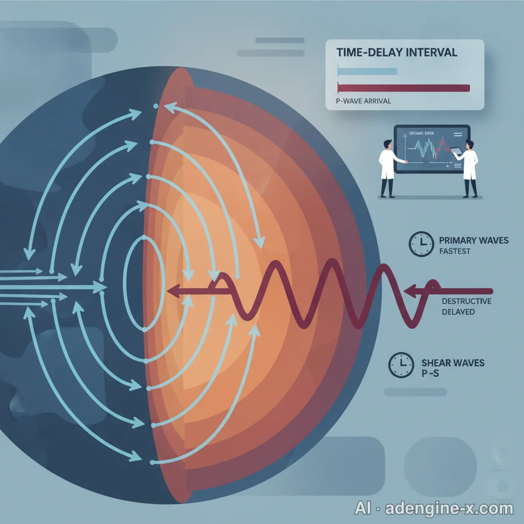
P-Waves vs. S-Waves: The Mechanical Velocity Differential
When an asperity on a fault ruptures, it generates two primary categories of body waves:
- Compressional Waves (P-Waves / Primary Waves): Traveling through crustal rock at velocities between 5.5 km/s and 6.5 km/s, P-waves are among the fastest seismic signals. They compress and dilate the rock in the direction of wave travel. Mechanically, you perceive a P-wave as a sudden, sharp vertical jolt, a rattle of windowpanes, or a low-frequency underground boom. P-waves rarely possess the sheer energy to collapse modern structures, but they carry invaluable diagnostic data.
- Shear Waves (S-Waves / Secondary Waves): Arriving behind the P-wave at approximately 3.2 km/s to 3.7 km/s, S-waves displace the ground perpendicularly to the direction of propagation. This intense lateral shearing and transverse motion causes structural deformation, wall cracking, racking of frame buildings, and heavy furniture tipping.
The time interval between the arrival of the P-wave and the destructive S-wave—known in technical geophysics as the S-P differential interval—is the bedrock upon which all modern Earthquake Early Warning (EEW) systems are constructed.
Digital Latency vs. Elastic Waves: Why Bits Outrun Fault Ruptures
In decades past, seismic awareness was strictly post-facto: regional observatories analyzed drum seismograms, ran automated triangulations over a 10-to-20-minute window, and then distributed wire reports to commercial television and radio broadcasters. By then, the event was over.
Today, light-speed packet transmission over fiber-optic and cellular networks has changed the rules of engagement. While a destructive S-wave requires roughly 28 to 30 seconds to travel 100 kilometers through continental crust, a data packet carrying telemetry from an epicentral borehole accelerometer reaches cloud servers and alert infrastructure within 200 to 500 milliseconds. This thermodynamic and electromagnetic reality provides users located outside the immediate fault rupture zone with a decisive tactical operational window—measured in seconds to tens of seconds—before structural shearing begins.
2. Core Detection Architectures: Specification and Benchmark Comparison
When you seek immediate confirmation of a seismic event, your request is intercepted by one of three primary technological frameworks: public geophysical networks, consumer sensor crowdsourcing, or behavioral web traffic clustering. Let us analyze their architectural specifications, operational latencies, and accuracy benchmarks.
| Evaluation Parameter | USGS ShakeAlert (Public Seismometers) | Google Android Alerts (MEMS Crowdsourcing) | EMSC LastQuake (Flashsourcing) |
|---|---|---|---|
| Core Infrastructure | 1,675+ hardened broadband seismometers and borehole GNSS sensors across CA, OR, WA | Low-cost MEMS accelerometers inside billions of active Android smartphones | Real-time website load spikes, mobile app opens, and geolocated API hits |
| Processing Latency | 1.5 to 3.8 seconds from P-wave detection to trigger | 2.0 to 5.0 seconds algorithmic server confirmation | 15 to 60 seconds (contingent on human user reaction speed) |
| Alert Latency & Reach | High-priority Wireless Emergency Alerts (WEA) and push notifications via MyShake | OS-level push alerts across 100+ countries with tier-based thresholds | Post-event information verification; non-preemptive warning |
| Data Precision | Grade-A scientific telemetry: exact acceleration, frequency, depth, moment magnitude ($M_w$) | Medium-High: probabilistic machine-learning spatial clustering | Medium: subjective human intensity mapping and geographic centroiding |
| System Blind Spot | High capital expenditure; geographically restricted to instrumented west coast states | iOS exclusion; potential urban noise false triggers (heavy transit, construction) | Zero advance warning capability (strictly post-shaking verification) |
| User Access Cost | Free Public Infrastructure | Free Built-in OS Utility | Free Open-Source Community Tool |
USGS ShakeAlert: High-Fidelity Borehole & GNSS Array Metrics
Operated by the United States Geological Survey alongside academic partners including Caltech, UC Berkeley, the University of Washington, and the University of Oregon, ShakeAlert is the scientific gold standard for the American West. Utilizing more than 1,675 seismic stations, its algorithmic backbones—such as the EPIC (Earthquake Point-source Integrated Code) and FinDer (Finite Fault Rupture Detector) algorithms—calculate the hypocenter, estimate initial magnitude, and map expected Modified Mercalli Intensity (MMI) within 1.5 to 3.8 seconds of initial rupture detection.

While seismologists emphasize that science cannot predict when an earthquake will initiate along a fault plane, telemetry systems can deliver immediate early warnings the moment physical rupture begins. Even three seconds provides enough time to drop beneath a desk, protect the cervical spine, shut off gas valves, and slow down transit systems—often making the difference between minor trauma and severe crushing injuries.
Google Android Alerts: The Billion-Device Crowdsourced MEMS Grid
For individuals residing outside dense public sensor networks, Google developed an alternative: the Android Earthquake Alerts System. Every modern smartphone incorporates a Micro-Electro-Mechanical Systems (MEMS) accelerometer—a microchip that senses device tilt and motion. When a phone is stationary and plugged in, the OS monitors high-frequency directional spikes matching P-wave signatures.
If hundreds of smartphones in a localized geographic cluster register simultaneous compressional impulses, Google's centralized servers run a rapid spatial correlation algorithm. If the event crosses a threshold of magnitude $M \ge 4.5$, the system pushes a two-tiered warning:
- "Be Aware" Alert: Dispatched for estimated MMI III (Weak) and IV (Light) ground shaking. It presents a notification banner with estimated intensity and general safety recommendations without overriding Do-Not-Disturb modes.
- "Take Action" Alert: Dispatched for destructive ground shaking of MMI V (Moderate) and above. It bypasses system sound profiles, sounds a loud, piercing tone, displays a high-contrast full-screen graphic, and instructs the user to drop, cover, and hold on immediately.
EMSC LastQuake: Behavioral Flashsourcing and Network Spikes
In Europe and developing regions, the European-Mediterranean Seismological Centre (EMSC) leverages human digital behavioral footprints through its platform, LastQuake, utilizing an approach known as "Flashsourcing." When ground shaking occurs, eyewitnesses rapidly visit web portals or mobile apps; detecting sudden, massive surges in traffic from a specific metropolitan area allows automated systems to triangulate an epicenter and estimate shaking intensity within seconds, even before seismic waveforms are fully analyzed.
3. Immediate Action Protocol: What to Do in the First 0 to 60 Seconds
If you are experiencing shaking right now, close your eyes to conceptual theories and execute mechanical survival procedures immediately. Here is the operational sequence based on decades of structural trauma analysis.
The Golden Window: Physics Behind the 3-to-5-Second Window
If your early warning alarm sounds, you typically have an operational buffer ranging from 3 to 5 seconds (if you are within 50 km of the epicenter) to 15 to 20 seconds (if you are 100 km out). Do not waste these seconds attempting to grab laptops, wallets, or pets that run under beds. Every micro-decision must focus purely on protecting your skull and vital organs.
Drop, Cover, and Hold On: Structural Biomechanics vs. Impact Trauma

Modern building codes across North America, Japan, and Western Europe are engineered to mitigate catastrophic total pancaking. Consequently, more than 80% of serious injuries and mortalities during earthquakes in developed nations do not stem from ceiling collapses, but from interior ballistic hazards: toppling solid-wood bookcases, flying microwaves, shattering structural plate glass, and collapsing unanchored acoustic ceiling panels.
- DROP: Drop immediately down to your hands and knees. This position protects you from being thrown off your feet by high-amplitude lateral S-waves and reduces your cross-sectional target area by over 60%.
- COVER: Crawl beneath a sturdy architectural element, such as an oak or steel dining table, a heavy workstation, or an interior structural desk. Place one forearm over the back of your neck and tuck your chin firmly into your sternum to protect your cervical vertebrae.
- HOLD ON: Grip the table legs firmly with your free hand. As ground accelerations shake the room, the furniture will slide across flooring; hold on so your protective shield moves with you rather than exposing your head.
Dynamic Micro-Environments: Bed, High-Rise, Highway, and Transit
Your physical environment dictates specific mechanical adaptations:
- If in Bed: Do not leap out into the dark where shards of broken glass or overturned furniture may lacerate your feet. Roll onto your stomach, pull your knees up beneath your chest, and pull a heavy down or memory-foam pillow over the back of your head and neck.
- If in a High-Rise Office Tower: Stay away from perimeter floor-to-ceiling curtain walls, exterior glazing, and heavy suspended architectural lighting. Do not, under any circumstances, run for the stairwells or elevator banks. High-rises are designed to flex laterally; accept the severe sway, drop beneath a workstation, and wait for resonance to subside.
- If Operating a Motor Vehicle: Activate your hazard warning blinkers, gradually decelerate, and steer smoothly to the right shoulder. Avoid stopping beneath overpasses, pedestrian footbridges, high-voltage transmission lines, or heavy roadside billboards. Set the parking brake and remain seated inside the steel chassis until vibrations cease.
4. Post-Shaking Verification: Sifting Signal from Noise in the First 15 Minutes
Once dynamic ground motion subsides, the immediate priority transitions from physical survival to environmental assessment and authoritative confirmation.
USGS Latest Earthquakes & Real-Time ShakeMap Resolution
To verify the physical reality of the event without fallacious internet gossip, go straight to the USGS Latest Earthquakes Map (earthquake.usgs.gov). The USGS processing pipeline operates on automated sensor convergence:
- 0 to 3 Minutes Post-Rupture: The system logs an automated preliminary alert. You will see a preliminary moment magnitude ($M_w$), calculated focal depth (e.g., shallow crustal ruptures at 5 to 10 km versus deep subduction slab events at 50+ km), and approximate geographic coordinates.
- 5 to 10 Minutes Post-Rupture: Human duty seismologists review waveform picks, filter out local sensor anomalies, lock in the final epicentral solution, and output an official ShakeMap displaying instrumental peak ground acceleration (PGA) and peak ground velocity (PGV).
The Citizen Science Engine: USGS "Did You Feel It?" (DYFI)
As soon as you are in a secure location, navigate to the "Did You Feel It?" (DYFI) portal on the USGS event page. Launched in 1999, this citizen science utility has processed over 5,000,000 individual shake reports globally. For historic perspective, during the 2011 Mineral, Virginia earthquake ($M_w$ 5.8), the DYFI system ingested over 148,000 reports within hours, mapping shaking perceptions up the entire Eastern Seaboard.
Even across well-instrumented seismic monitoring networks, physical sensors cannot capture localized ground motion amplification occurring on every residential street corner. The thousands of eyewitness reports submitted by the public via 'Did You Feel It?' provide crucial calibration data that directly refine structural impact estimates and inform rapid emergency response assessments.
Social Media Flash Dynamics: The "Twitter Effect" and Regional Subreddits
Before automated systems refresh, real-time social networks function as distributed, crowdsourced human seismometers. In cities like Los Angeles, San Francisco, Tokyo, and Taipei, queries like "Did anyone just feel that?" flood platforms like X and location-specific subreddits (such as r/losangeles or r/bayarea) within 5 to 10 seconds.
This "Twitter Effect" occurs because optical internet data packets travel nearly 100,000 times faster than mechanical elastic shear waves. A resident located 150 kilometers away from an epicentral rupture can literally read an X post from someone at the epicenter stating "Huge earthquake!" 10 to 15 seconds before the physical S-waves arrive to rattle their own desk.
5. Hardware Setup and Configuration: Optimizing Mobile Detection Nodes
Early warnings are completely useless if your mobile devices are misconfigured or muting critical governmental data payloads. Here is the operational setup checklist for both major smartphone operating systems, along with advanced hobbyist telemetry tools.
Android OS: Calibrating Background Detection & Alert Thresholds
Android devices provide integrated native early warning without requiring third-party software installations. Verify the following parameters are active:
- Navigate to: Settings $\rightarrow$ Safety & Emergency $\rightarrow$ Earthquake Alerts. Toggle the switch to ON.
- Ensure Google Location Accuracy is activated under your system's advanced location services. The MEMS background detection algorithms require localized spatial clustering to distinguish between a passing concrete mixer and an actual crustal rupture.
- Confirm that critical emergency alerts are whitelisted to override system Do Not Disturb (DND) rules.
iOS Configuration: Enabling Carrier Wireless Emergency Alerts (WEA)
While Apple does not currently crowdsource internal iPhone accelerometer telemetry for public warning calculations, iOS natively displays municipal and federal ShakeAlert alerts via the cellular carrier WEA pipeline:
- Navigate to: Settings $\rightarrow$ Notifications. Scroll to the bottom of the interface.
- Under the Government Alerts heading, ensure that Emergency Alerts, Public Safety Alerts, and Test Alerts (optional) are toggled to ON.
- For enhanced low-latency telemetry in the American West, download the university-developed MyShake application (developed by the UC Berkeley Seismological Laboratory) and ensure its background location permissions are set to "Always Allow".
DIY Seismology: Deploying Raspberry Shake Geophones at Home
For high-precision local monitoring, a burgeoning global community of enthusiasts deploys Raspberry Shake hardware modules. Combining a calibrated 4.5 Hz geophone or triaxial MEMS accelerometer with a Raspberry Pi single-board computer, these $400 to $600 citizen observatories connect to an open global network. They stream local velocity spectra directly to global databases, granting users personal, real-time waveform feeds from their own basements.
6. Critical Pitfalls, Lethal Myths, and Engineering Realities
During an emergency, misinformation travels faster than seismic waves. Several persistent survival myths continue to cause preventable physical injuries during major ruptures.
Deconstructing the "Triangle of Life" Fallacy
Few theories have caused more concern among search-and-rescue teams than the debunked "Triangle of Life" hypothesis. This concept claims that when buildings collapse, ceilings fall onto large pieces of furniture, leaving a safe, triangular void space adjacent to them where humans should curl up.
Joint findings from the American Red Cross and the Structural Engineers Association of Northern California (SEAONC) emphatically refute this model:

"The 'Triangle of Life' is an unscientific concept based on catastrophic structural collapses in unreinforced masonry buildings in developing nations. In structures built under modern building codes, opting to curl up next to a desk or sofa instead of crawling beneath it leaves you completely vulnerable to toppling appliances, tumbling file cabinets, and flying structural debris, which cause the overwhelming majority of earthquake injuries."
The Abandoned "Doorway Myth" in Modern Structural Framing
Generations of schoolchildren were taught to run for the nearest doorway during an earthquake. While this advice had merit during the nineteenth century when unreinforced adobe or heavy log cabins featured thick, load-bearing timber doorframes, it is dangerous in modern drywall and light-gauge steel construction. Modern interior doorframes are structurally no stronger than any adjacent partition wall. Worse, strong lateral ground motions cause doors to swing violently on their hinges, regularly crushing hands, fracturing fingers, or knocking individuals unconscious.
The Post-Tremor Gas Leak Hazard and Infrastructure Secondary Shocks
Surviving the initial shaking is only half the battle. Secondary hazards—most notably fires fueled by fractured municipal gas mains—regularly eclipse mechanical shaking damage, as demonstrated during the historic 1906 San Francisco and 1995 Kobe disasters.
- Zero Open Flames: Never light matches, flick lighters, strike candles, or activate light switches immediately following a major tremor. Leaking natural gas requires only a single spark to trigger a localized structural explosion. Use battery-powered LED flashlights only.
- Utility Isolation: If you smell rotten eggs (the distinct odorant mercaptan added to natural gas supplies) or hear high-pressure hissing, isolate your primary structural gas shutoff valve using a non-sparking crescent wrench, open your perimeter windows, and evacuate the building on foot immediately.
7. Structural Physics: The Blind Zone Dilemma and Propagation Limits
Even the most advanced real-time warning technology faces insurmountable physical constraints governed by wave mechanics and electronic latency.
The Epicentral Blind Zone: The Mathematical Limit of EEW
The Epicentral Blind Zone is the geographic circle surrounding the earthquake's epicenter where destructive S-waves arrive before algorithmic telemetry can process P-wave data and dispatch an electronic alert. Let us analyze the arithmetic:
- If an earthquake ruptures at a shallow depth of 8 km, the P-wave requires approximately 1.5 seconds to reach the nearest ground sensor.
- The sensor array requires roughly 2.0 seconds to log four wave cycles, transmit waveforms to a computational hub, run algorithmic triangulation (EPIC/FinDer), and confirm the threshold magnitude.
- Dispatching the resulting payload to cloud content distribution networks and wireless carrier towers requires an additional 1.0 to 1.5 seconds.
Total latency: roughly 4.5 to 5.0 seconds. During those same 5 seconds, destructive S-waves traveling outward at 3.5 km/s will have already surged across an area extending 17.5 to 20 kilometers from the epicenter. Consequently, individuals closest to the rupture plane—who experience the highest peak ground accelerations—cannot receive an advance digital early warning. The physical tremor itself serves as their only warning.
Local Ground Motion Amplification and Soil-Structure Resonance
Why do two individuals located three blocks apart experience wildly divergent shaking sensations? The answer lies in site characterization and soil mechanics. Deep, soft, water-saturated sedimentary soils, loose alluvium, or artificial land reclamation fills (such as San Francisco's Marina District) dramatically slow down seismic waves. To conserve wave energy flux, the wave amplitude surges violently, amplifying surface shaking by factors of 300% to 500% compared to bedrock sites.

Furthermore, when the fundamental natural vibration frequency of a building matches the dominant resonant frequency of the passing seismic waves, harmonic resonance occurs, magnifying structural drift and accelerating structural stress.
8. The Next Frontier: AI Nowcasting, Fiber DAS, and Autonomous Infrastructure
Seismic detection systems are evolving from passive post-event indicators into predictive, machine-to-machine computational networks.
Deep-Learning Phase Picking: Single-Station P-Wave Inference
Current early warning architectures typically require simultaneous trigger convergence across at least three to four distinct geographic sensor nodes to rule out false triggers, such as passing freight trains or quarry blasts. Research teams at Caltech and Stanford are deploying convolutional neural networks (CNNs) trained on millions of historical seismograms. These deep-learning models can identify characteristic P-wave signatures and infer estimated moment magnitude from just the initial 0.5 seconds of waveform telemetry recorded at a single sensor station. This advancement will shave 1.5 to 2.5 seconds off alert pipelines, narrowing the epicentral blind zone significantly.
Distributed Acoustic Sensing (DAS): Subsea Fiber Networks
The vast majority of Earth's most dangerous megathrust faults reside offshore along subduction zones (such as the Cascadia Subduction Zone or the Japan Trench), where traditional borehole seismometer installation and maintenance cost millions of dollars per node. Scientists are now implementing Distributed Acoustic Sensing (DAS).
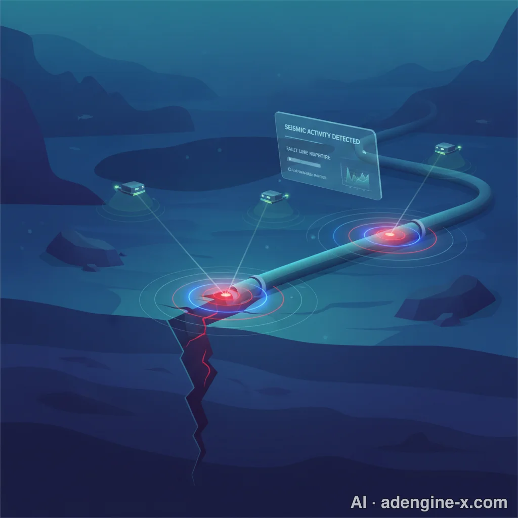
By firing stable optoelectronic laser pulses through existing commercial transoceanic telecommunications fiber-optic cables, researchers measure microscopic Rayleigh backscatter phase variations caused by passing seismic waves. In effect, hundreds of kilometers of seabed fiber cables are converted into continuous arrays of tens of thousands of virtual seismic sensors, providing unprecedented visibility into offshore subduction ruptures minutes before tsunamis or landward shaking manifest.
Machine-to-Machine (M2M) Grid Interlocks: Halting Trains and Isolating Gas
The ultimate goal of "Earthquake Now" technology is autonomous infrastructural self-defense without human intervention:
- High-Speed Rail: Systems like Japan's Shinkansen UrEDAS link early warning feeds directly to sub-station track switches, cutting power and triggering automated fail-safe regenerative pneumatic braking to bring trains traveling at 300 km/h to a controlled stop before hitting displaced tracks.
- Surgical and Medical Robotics: Hospital surgical units use automated triggers to park articulating robotic arms instantly, retract delicate instruments, and switch operating rooms to uninterruptible power systems (UPS).
- Metropolitan Gas and Grid Infrastructure: Municipal distribution hubs trigger high-speed electromagnetic safety valves, isolating high-pressure city gas mains and sectionalizing regional electrical power distribution grids to eliminate transformer explosions and subsequent firestorms.
9. Frequently Asked Questions: Expert-Backed Clarifications
FAQ 1: Can scientists predict the exact time and epicenter of an earthquake beforehand?
No. Neither the USGS, Caltech, nor any credible academic geophysicist has ever predicted the exact day, hour, and coordinate of an upcoming earthquake. Fault systems exhibit highly nonlinear, chaotic stick-slip frictional mechanics. We can generate long-term probabilistic seismic hazard forecasts (e.g., "There is an estimated 72% probability of an $M_w \ge 6.7$ event in the San Francisco Bay Region within the next 30 years"), but exact short-term prediction remains physically impossible with our current understanding of physics. Any social media account claiming to have an exact date-and-time prediction is peddling pseudoscientific conjecture.
FAQ 2: Why did my phone alert go off after I already felt the violent shaking?
If you experienced shaking before your device issued an audible notification, you were located within the Epicentral Blind Zone. Because your distance to the rupture plane was less than 15 to 25 kilometers, the mechanical S-waves reached your location faster than the initial P-waves could be processed by regional server networks and rebroadcast across cellular towers. Early warning works best for locations situated at moderate-to-large epicentral distances.
FAQ 3: Do animals really anticipate earthquakes through a sixth sense?
Animals do not possess supernatural precognition; they simply possess more acute biological sensors than humans. Dogs, cats, horses, and birds frequently react with abrupt distress, vocalizing or fleeing seconds before people notice any shaking. In reality, animals are sensing the high-frequency compressional P-wave—which passes through the ground quietly and goes largely unnoticed by human sensory thresholds—seconds before the violent, low-frequency S-wave arrives.
FAQ 4: What is the difference between Magnitude (Mw) and Intensity (MMI)?
Magnitude (measured today via the Moment Magnitude scale, $M_w$) represents a singular, fixed value quantifying the total mechanical energy released at the fault rupture plane. It does not change with your location. An $M_w 7.0$ earthquake releases a set quantity of energy. Conversely, Intensity (quantified via the Modified Mercalli Intensity scale, MMI) measures the localized strength of ground shaking and structural impact at a specific geographic point on the surface. An $M_w 7.0$ event will register a devastating MMI VIII or IX at its immediate epicenter, but fade to an MMI III or IV 150 kilometers away.
FAQ 5: What should I pack for an immediate 72-hour post-earthquake scenario?
A self-contained Go-Bag should sit by your home entryway. At a minimum, your kit should contain:
- Water: One gallon of potable water per person per day (three-day minimum requirement).
- Nutrition: 72 hours of non-perishable, high-calorie energy bars or MREs requiring zero cooking or water addition.
- Hydraulic / Manual Tools: A heavy-duty, non-sparking gas shutoff wrench, a pry bar, and work gloves with reinforced leather palms to clear window glass.
- Medical Supplies: Tourniquets, pressure bandages, antiseptic flushes, splints, and a two-week supply of critical personal prescription medications.
- Power & Communications: A hand-crank NOAA emergency weather radio, LED headlamps, and a high-capacity (20,000+ mAh) external lithium-ion battery pack with appropriate charging cables.
ℹ️ This article was drafted with the help of an AI tool and reviewed/edited by a human before publishing. · Original: AdEngine-X
📚 References
This list may include both live search sources the AI referenced while writing and public-data sources checked during fact verification. Please verify the original sources before citing or reusing.
0 Comments
Loading comments...